GRASS on the #RaspberryPi - Raspberry Pi Pod and micro:bit base
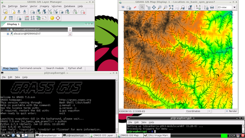
GRASS GIS is a Geographic Information System used for geospatial data management and analysis, image processing, graphics/map production, spatial modeling, and visualization. They now have a Raspberry Pi version.Read more →
Michael Horne